Aerial Mapping & Surveying
Achieve high-precision aerial mapping and rapid data acquisition for surveying projects.
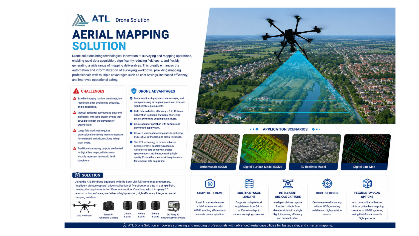
ATL H9 equipped with the Sony LR1 full-frame mapping camera enables intelligent oblique capture, centimeter-level RTK positioning, and efficient 3D reconstruction workflows. The solution significantly reduces fieldwork costs, shortens project cycles, and delivers high-quality mapping outputs including DOM, DSM, 3D models, and digital line maps.